

Cemetery wayfinding: can a first-time visitor find the chapel?
Can visitors find the chapel from the car park? Explore BlinkOut’s cemetery signage in Hilversum and learn how to test the routes across your own grounds.
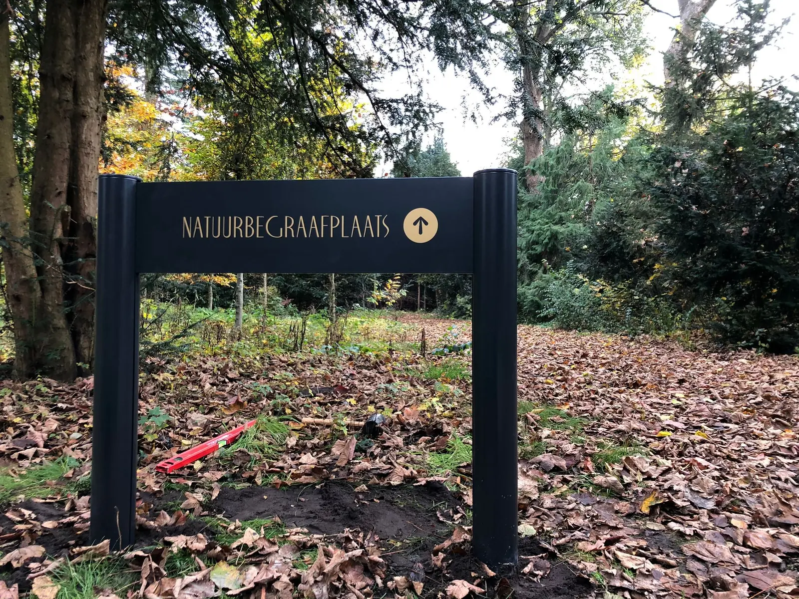
The funeral notice gives the time of the service. Once you arrive at the car park, you need to know which path leads to the chapel. At a moment like this, a visitor should be able to make that first decision at a glance. The photographs show the wayfinding signage BlinkOut produced for Uitvaartstichting Hilversum. Here is how to check whether visitors can find their way across your grounds.
Start with the name on the funeral notice
Take a copy of the directions visitors receive and stand at the entrance. If the notice says “chapel” but the first sign gives only the building name, a newcomer has to work out that the two names mean the same place. Use a recognisable name on the notice, on the site map, at junctions and beside the door. If there are two chapels, include the building name from the first decision point.
Walk from the car park and from the pedestrian gate
A driver who has just parked may approach a sign from a different angle to someone arriving on foot. Walk both routes on a normal visiting day. Where can you first see a destination name? Can you read the arrow before the path divides? Check from seated height as well. A parked vehicle, a hedge or a group waiting near the entrance can obscure a sign that looked perfectly clear on the plan.
A map at the entrance and an arrow at the fork
A map helps visitors understand how the paths and buildings fit together. Mark their current position and check that the map makes sense from where they stand. At a fork farther along the path, a single direction may be more useful than a second map. Place the name beside the arrow on the approach to the junction so visitors can choose before they reach it.
Check the site wayfinding signs on the return journey. Someone leaving the chapel sees the same junction from the opposite side. Can they find the exit or the car park? Photograph each approach. A single panel might look sufficient on the plan while showing only its back to visitors walking home.
What the photographs from Hilversum show
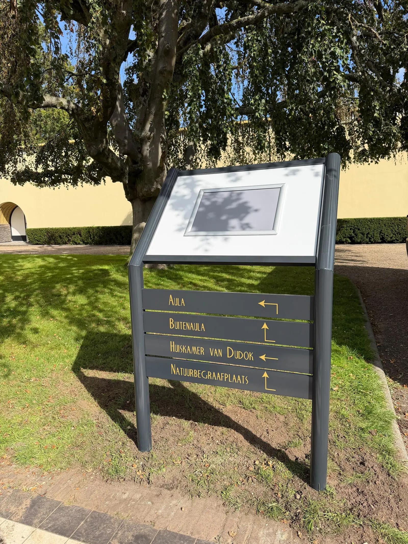
BlinkOut produced directional signs, maps and information boards for Uitvaartstichting Hilversum. The opening photograph shows a sign among the trees pointing towards the natural burial ground. The second shows a site map beside individual direction panels, including Aula and Betula. One sign identifies a single destination along a path. The other brings several destinations together at a decision point.
Try the route with a first-time visitor
Ask a colleague who rarely visits the grounds to walk from the gate to the chapel and find the way back to the car park. Let them lead. Note the first place where they stop, look back or reach for their phone. Wait until the end to ask what information they needed. A sign may already be there and still come into view too late.
For each problem spot, write down the decision a visitor needs to make. Moving an existing panel may be enough. Elsewhere, turning an arrow or using the same destination name in two places may solve the problem. Walk the route again after the change, including at dusk if the grounds are open then.
For a review of your site, gather a plan, the destination names and photographs taken from the main directions of approach. Discuss your site with BlinkOut.